

SKU:
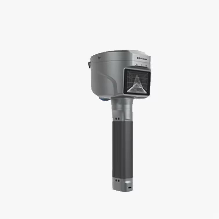
V700S 3D Scanner
Couldn't load pickup availability
1 x V700S, 1 x Controller,
1 x Bipod, 1 x Pole
Hi-Target V700S is a professional SLAM RTK 3D LiDAR laser scanner designed for surveying, mapping, engineering, and 3D data collection. It combines LiDAR scanning, SLAM positioning, GNSS/RTK technology, imaging, and real-time positioning to capture detailed 3D spatial data in both open-sky and GNSS-challenged environments.
By combining LiDAR, SLAM, and RTK GNSS, the scanner can support mobile 3D surveying without relying entirely on conventional GNSS positioning.
Key Benefits
- Professional handheld 3D LiDAR laser scanning
- Integrated SLAM and RTK GNSS positioning
- Suitable for indoor and outdoor 3D data collection
- Supports point cloud capture for surveying and mapping
- Designed for engineering and construction applications
- Useful in areas where GNSS signals are limited or unavailable
- High-speed laser scanning for efficient field data collection
- Portable design for mobile 3D scanning
- Supports detailed spatial data acquisition
- Suitable for professional surveying and 3D mapping workflows
Hi-Target V700S SLAM RTK Features
3D LiDAR Laser Scanning
The V700S uses LiDAR technology to capture surrounding objects and environments as 3D spatial data. The scanner can be used to collect point cloud information for buildings, structures, terrain, infrastructure, and other physical environments.
Its laser scanning system supports a measurement rate of up to 200,000 points per second, helping professionals collect dense spatial data efficiently.
SLAM Positioning
The integrated SLAM system helps the V700S determine its position while scanning and moving through an environment. This makes the system particularly useful for indoor areas and other locations where reliable GNSS reception may be difficult.
RTK GNSS Positioning
The V700S combines SLAM with GNSS/RTK positioning to support professional surveying workflows. The system provides centimetre-level RTK positioning performance under suitable measurement conditions.
Portable 3D Surveying
The handheld design allows surveyors and field professionals to move through the survey area while collecting 3D data. This can make data collection more convenient for complex environments compared with traditional stationary scanning workflows.
Technical Specifications
| Specification | Hi-Target V700S |
| Brand | Hi-Target |
| Model | V700S |
| Product Type | SLAM RTK 3D LiDAR Laser Scanner |
| Scanning Technology | LiDAR |
| Positioning Technology | SLAM + GNSS/RTK |
| Laser Measurement Rate | Up to 200,000 points/sec |
| Scanning Range | 0.1–40 m at 10% reflectivity; 0.1–70 m at 80% reflectivity |
| GNSS Channels | 1,408 |
| RTK Horizontal Accuracy | 8 mm + 1 ppm |
| RTK Vertical Accuracy | 15 mm + 1 ppm |
| Tilt Survey Performance | 8 mm + 0.3 mm/° tilt |
| Data Output | 3D point cloud and spatial survey data |
| Applications | Surveying, mapping, construction, engineering and 3D data collection |
Applications of the V700S 3D Laser Scanner
Land and Engineering Surveying
The Hi-Target V700S can be used for collecting 3D spatial information for engineering surveys, site documentation, measurements, and mapping projects.
Construction and Building Surveying
Capture detailed 3D information from construction sites and existing structures for documentation, inspection, measurement, and project workflows.
Indoor 3D Mapping
SLAM positioning makes the V700S suitable for indoor environments where satellite positioning can be restricted, including buildings, facilities, and other enclosed spaces.
Infrastructure and Road Surveying
The mobile scanning approach can help professionals collect spatial information from roads, infrastructure, structures, and other large survey areas.
Industrial and Facility Mapping
The scanner can capture 3D information from industrial environments and facilities for documentation, measurement, and spatial analysis.
Why Choose the Hi-Target V700S?
The Hi-Target V700S SLAM RTK 3D LiDAR Scanner brings several positioning and scanning technologies together in one portable system. Its combination of LiDAR scanning, SLAM positioning, and GNSS/RTK makes it suitable for professional applications that require efficient 3D spatial data collection across different environments.
It is particularly useful when a surveying team needs to move quickly through an area while maintaining a reliable positioning workflow.
Who Is the Hi-Target V700S For?
The V700S is suitable for:
- Land surveyors
- Surveying companies
- Civil engineers
- Construction professionals
- Mapping professionals
- GIS professionals
- Infrastructure contractors
- Industrial survey teams
- 3D scanning service providers
- Engineering consultants
-
Vendor:
Hi-Target